Elementor #2311
Total Stations
RTK GNSS


RTK GNSS
RTK GNSS
RTK GPS

Accessories
GNSS Antennas & Accessories
Total Stations
RTK GPS
GeoSLAM LiDAR
Surveying Solutions
Smart Surveying
LiDAR & Mapping
Surveying Solutions
Smart Surveying
LiDAR & Mapping
Surveying Solutions
Smart Surveying
LiDAR & Mapping
Surveying Solutions
Smart Surveying
LiDAR & Mapping
FJD
Smart SurveyingGEOSLAM
LiDAR & Mapping(●) Hi-Target
Surveying Solutions
RTK GNSS Receivers View All >
V700S NEW
Flagship RTK with laser scanner, dual cameras, AR stakeout and 1408 channels.
~$13,000
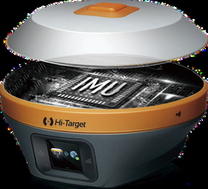
V600L
Laser RTK with IMU, dual camera and 15 km LoRa radio. 2 cm accuracy within 10 m in GNSS-denied areas.
~$7,000
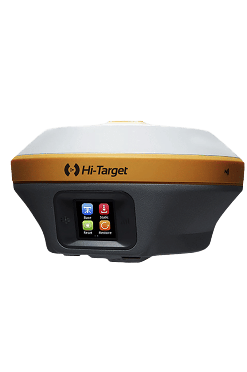
iRTK5
1408-channel RTK with Hi-Fix, IMU tilt survey, 360° antenna and multi-protocol radio. Comes with iHand55 controller.
~$10,000
Total Stations View All >
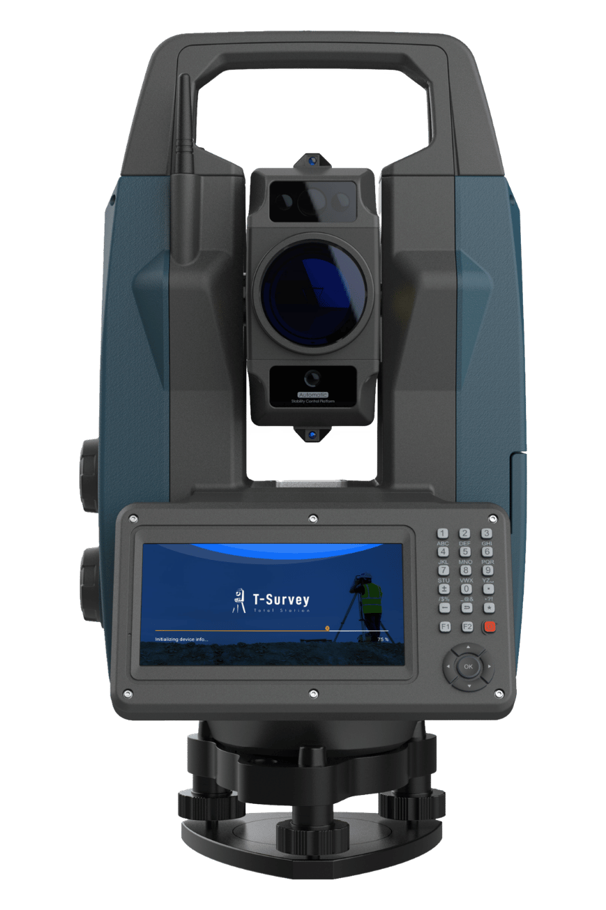
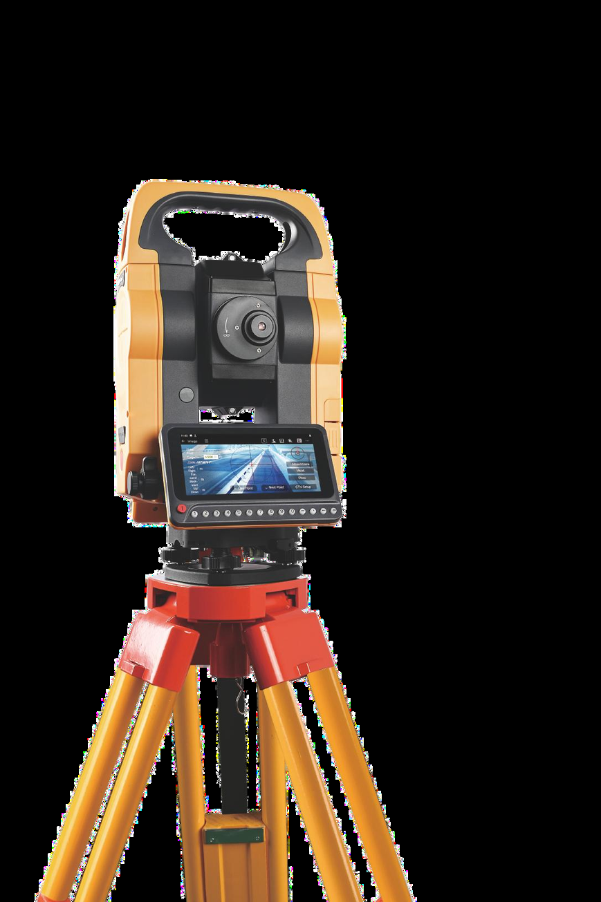
HTS-820
Robotic Total Station with AI prism tracker, smart imaging, 2" accuracy and 5000 m prism range.
~$12,000
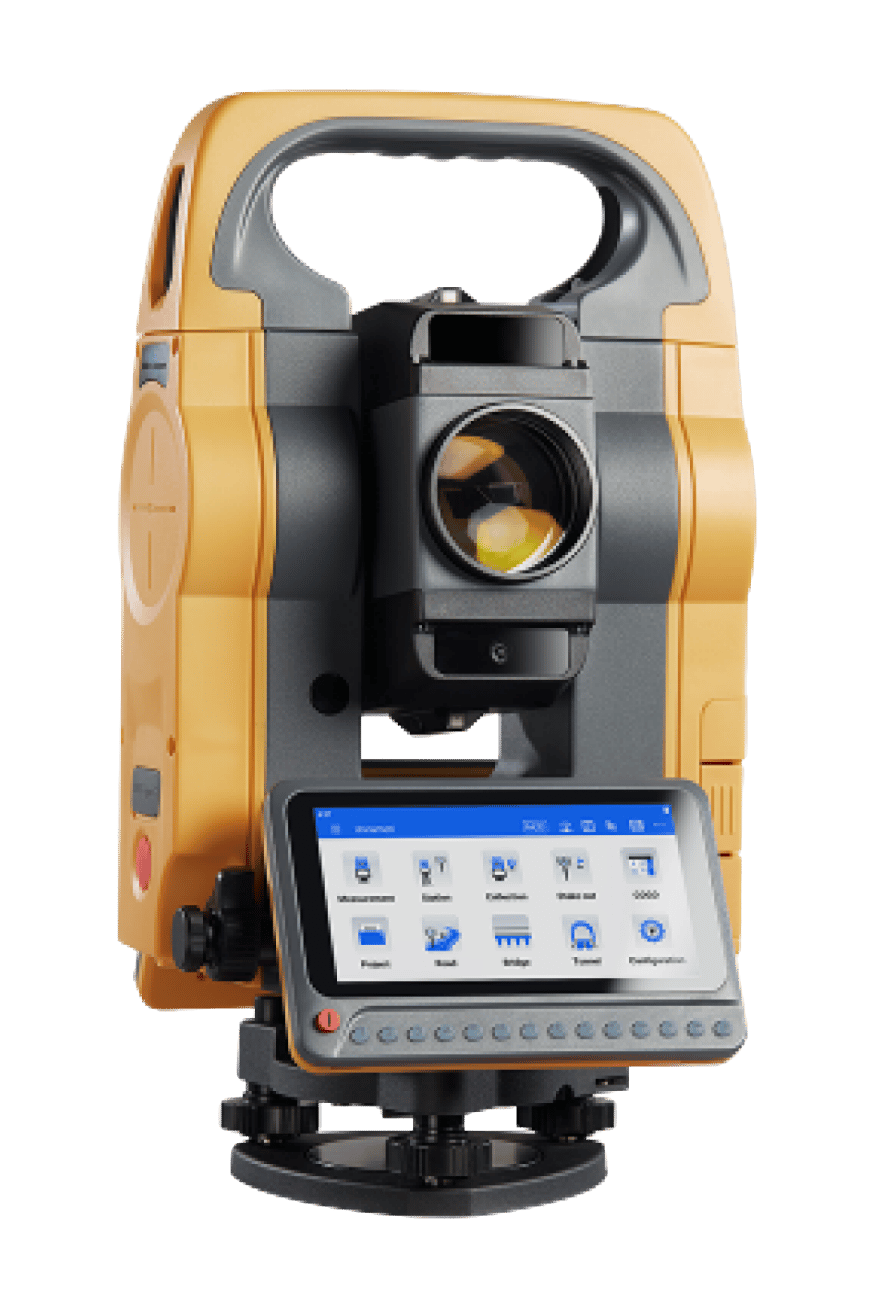
HTS-720
Android Total Station with 8MP camera, visual stakeout, 1"/2" accuracy and 1000 m reflectorless range.
~$8,000
GNSS Network / CORS View All >
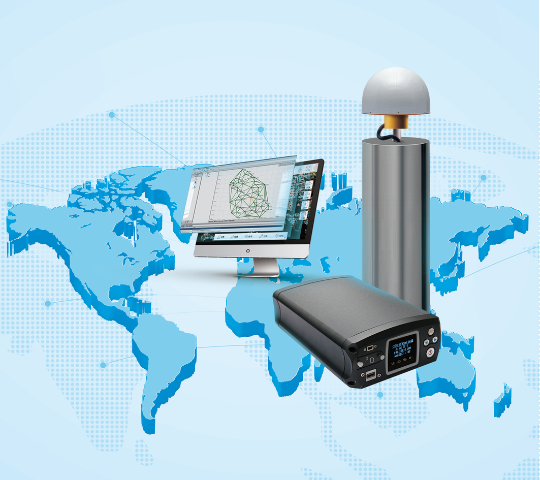
VNet8
1408-channel reference receiver for CORS/VRS. 64GB storage, 15+ hours battery, IP68 and secure communication.
GNSS Antennas

AT-45101CP
3D choke ring antenna, IGS/NGS certified.

AT-4500
Full-band high-precision GNSS antenna.

AT-35101H
Geodetic surveying antenna.

AH-4236
Compact antenna for drones and robots.

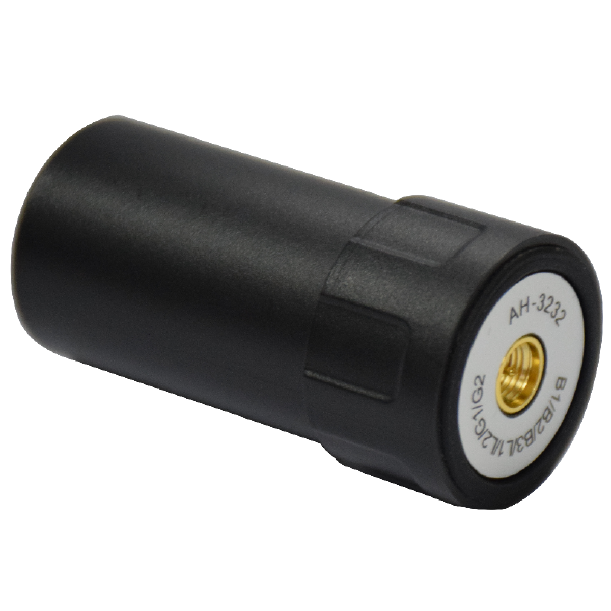
AH-3232
Ultra-compact antenna for UAV/USV.
FJD
Smart Surveying Solutions

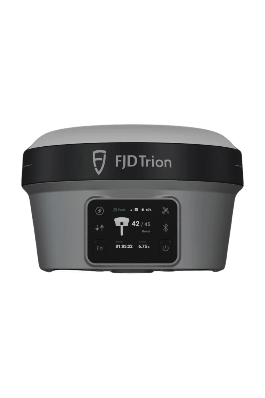
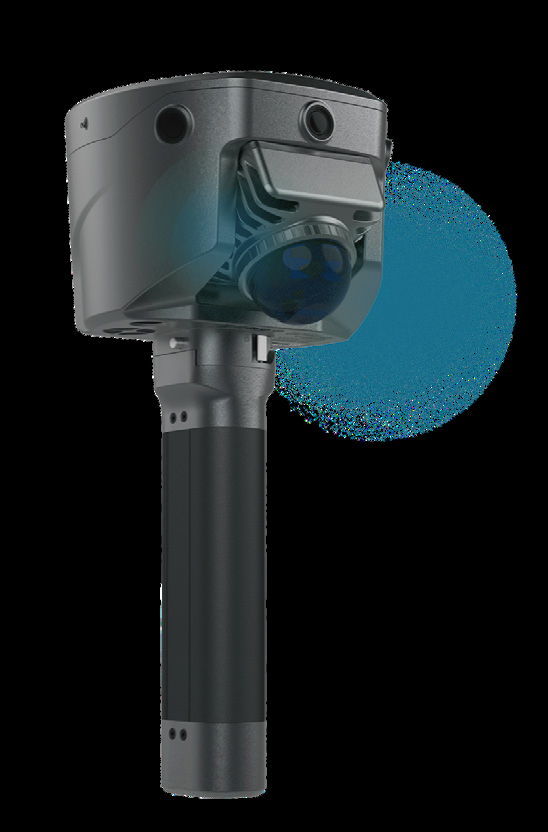
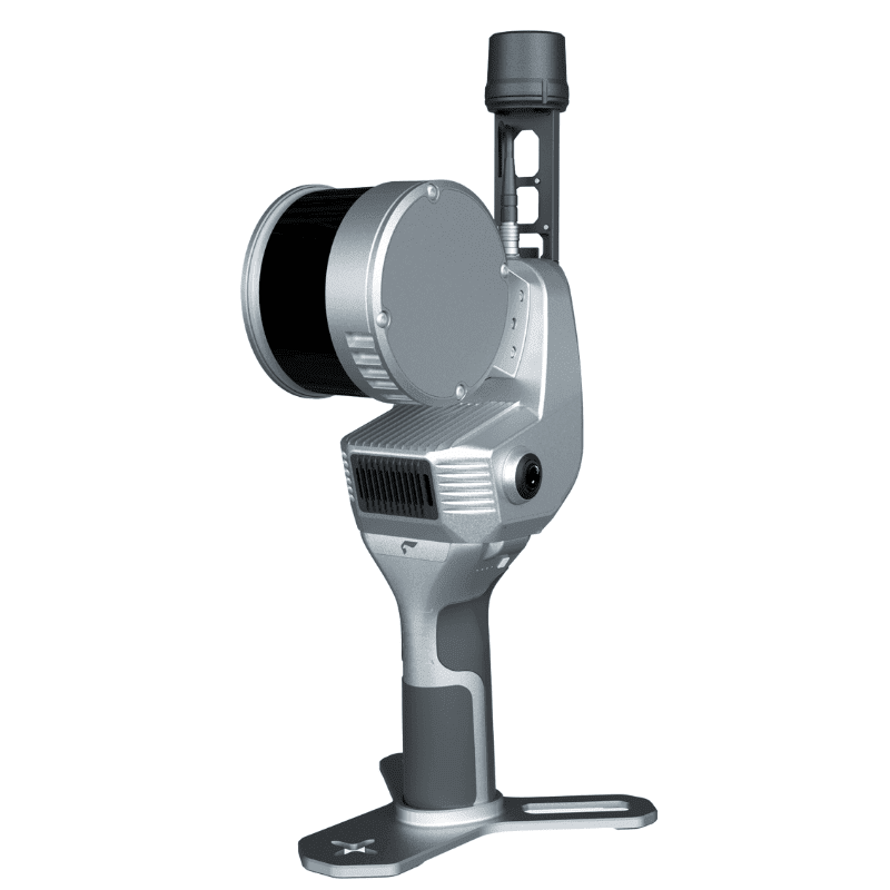
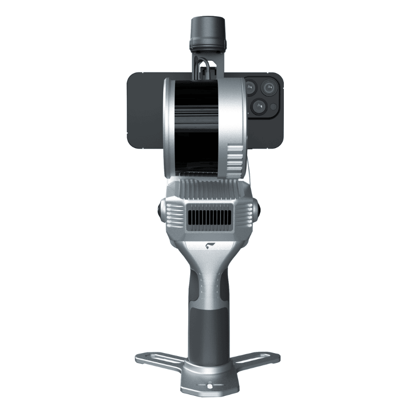
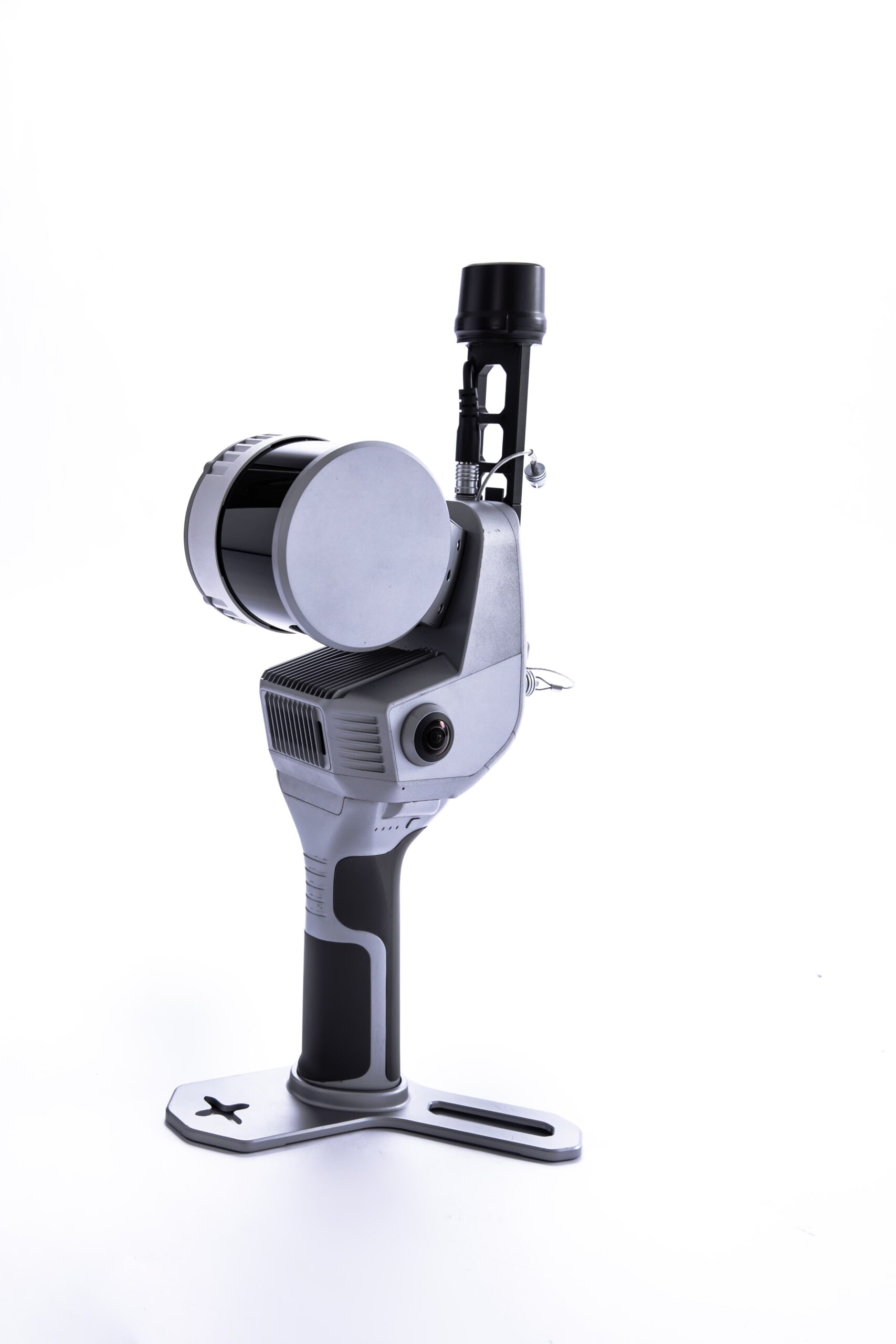
FJD Trion V10Li NEW
Laser RTK System with visible green laser, 2MP night-vision camera, AIM+ interference suppression, auto-alignment and 2nd gen IMU.
2 cm Accuracy
5 m Laser Range
AGC up to 80 m
~$8,000
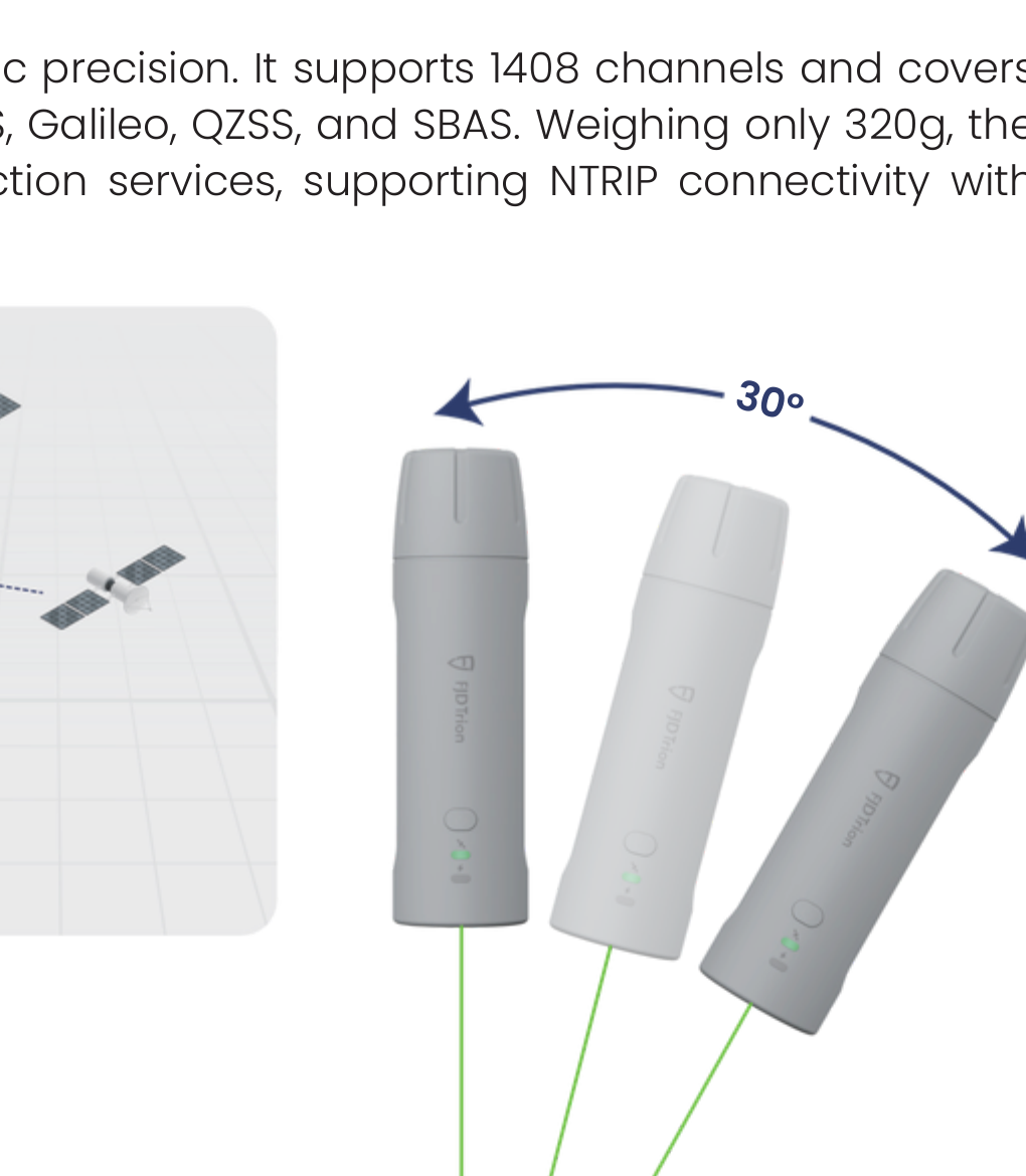
FJD Trion V4E Mini RTK
Pocket-sized RTK receiver (320 g) with 1408 channels, IMU tilt survey, LiDAR rangefinder and 12+ hours battery life.
H≤0.8 cm + 1 ppm
30° Tilt Survey (Pro)
IP67 & 1.2 m Drop
~$4,000
GEOSLAM
LiDAR & Mapping Solutions
GeoSLAM 200 e
Handheld LiDAR scanner designed for fast, accurate 3D data capture in any environment.
GeoSLAM 200
Advanced mobile mapping system delivering high-quality point clouds quickly and efficiently.
GeoSLAM Software
Powerful processing software for point cloud data, registration, visualization and deliverables.


GEOSLAM
LiDAR & Mapping
Surveying Solutions
RTK GNSS Receivers
View All >

V700S NEW
Flagship RTK with laser scanner, dual cameras, AR stakeout and 1408 channels.
~$13,000

V600L
Laser RTK with IMU, dual camera and 15 km LoRa radio. 2 cm accuracy within 10 m in GNSS-denied areas.
~$7,000

iRTK5
1408-channel RTK with Hi-Fix, IMU tilt survey, 360° antenna and multi-protocol radio. Comes with iHand55 controller.
~$10,000
Total Stations
View All >

HTS-820
Robotic Total Station with AI prism tracker, smart imaging, 2" accuracy and 5000 m prism range.
~$12,000

HTS-720
Android Total Station with 8MP camera, visual stakeout, 1"/2" accuracy and 1000 m reflectorless range.
~$8,000
GNSS Network / CORS
View All >

VNet8
1408-channel reference receiver for CORS/VRS. 64GB storage, 15+ hours battery, IP68 and secure communication.
GNSS Antennas

AT-45101CP
3D choke ring antenna, IGS/NGS certified.

AT-4500
Full-band high-precision GNSS antenna.

AT-35101H
Geodetic surveying antenna.

AH-4236
Compact antenna for drones and robots.
AH-3232
Ultra-compact antenna for UAV/USV.
Smart Surveying Solutions

FJD Trion V10Li NEW
Laser RTK System with visible green laser, 2MP night-vision camera, AIM+ interference suppression, auto-alignment and 2nd gen IMU.
2 cm Accuracy
5 m Laser Range
AGC up to 80 m
~$8,000

FJD Trion V4E Mini RTK
Pocket-sized RTK receiver (320 g) with 1408 channels, IMU tilt survey, LiDAR rangefinder and 12+ hours battery life.
H≤0.8 cm + 1 ppm
30° Tilt Survey (Pro)
IP67 & 1.2 m Drop
~$4,000
LiDAR & Mapping Solutions

GeoSLAM 200 e
Handheld LiDAR scanner designed for fast, accurate 3D data capture in any environment.

GeoSLAM 200
Advanced mobile mapping system delivering high-quality point clouds quickly and efficiently.
GeoSLAM Software
Powerful processing software for point cloud data, registration, visualization and deliverables.
GEOSLAM
LiDAR & MappingGEOSLAM
LiDAR & Mapping Solutions
LiDAR Scanners
High accuracy LiDAR scanners for 3D data collection

SLAM Systems
Mobile mapping solutions for indoor and outdoor
Software Solutions
Powerful software for point cloud processing
PRODUCTS

HI-TARGET
Surveying Solutions
GPS RTK
 High accuracy GNSS receivers for surveying and mapping
TOTAL STATION
 Robotic total station for precise measurements
DJI
Drone & Aerial Solutions
P4 / PPK
 High performance drones for mapping and surveying
L2 / LiDAR
 LiDAR payloads for accurate data capture
GEOSLAM
LiDAR & Mapping Solutions
LiDAR Scanners
High accuracy LiDAR scanners for 3D data collection
SLAM Systems
Mobile mapping solutions for indoor and outdoor
Software Solutions
Powerful software for point cloud processing
High Accuracy
Reliable Performance
Seamless Integration
Professional Solutions
Global Support
HI-TARGET
Surveying Solutions


DJI
Drone & Aerial Solutions


GEOSLAM
LiDAR & Mapping

