
3D Laser Scanning Services in Dubai
Sicher 3D delivers 1 mm-accurate 3D laser scanning, point cloud processing, BIM, and Revit modeling for architects, engineers, contractors, and surveyors across Dubai and the UAE — turning real buildings into precise, build-ready digital data.
Sicher 3D is a Dubai-based 3D scanning and BIM services company that converts physical buildings and sites into millimetre-accurate point clouds, Revit models, and as-built drawings.
3D Laser Scanning & Point Cloud
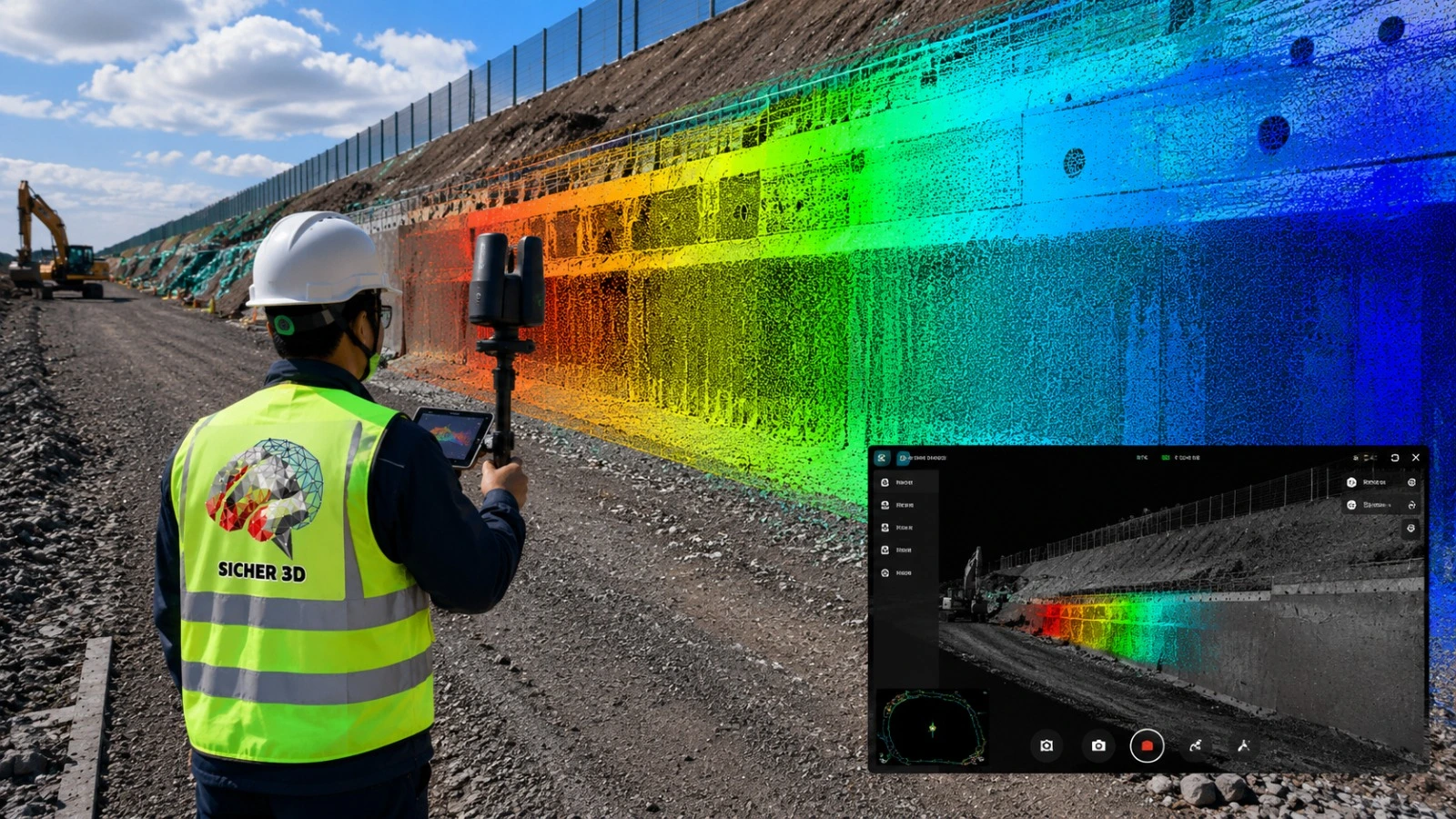
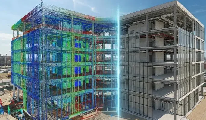
We scan your building or site into a dense, millimetre-accurate point cloud — millions of measured points that capture every wall, beam, and pipe exactly as built.
- Up to 1 mm accuracy, survey-grade
- Indoor, outdoor, and complex industrial sites
- Registered point cloud delivered in RCP / E57
Scan to BIM & Revit Modeling
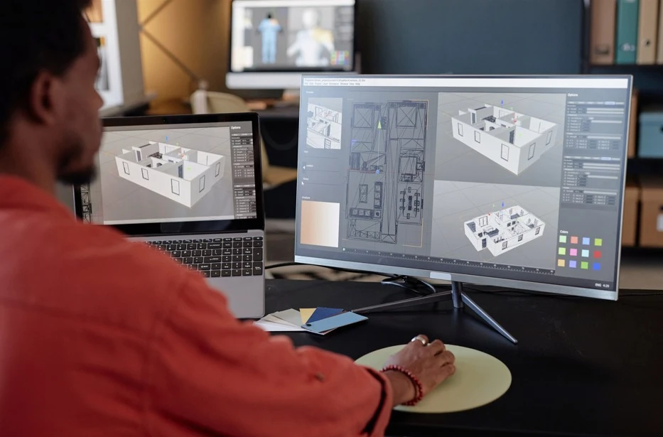
Our in-house team turns the point cloud into an intelligent BIM model in Revit — accurate architectural, structural, and MEP geometry your design team can build from immediately.
- LOD 100–500, to your project standards
- Clash detection & MEP coordination
- Delivered as RVT, IFC, and DWG
As-Built Drawings & Digital Twins
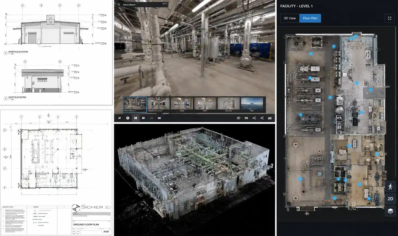
From the same scan data we produce verified as-built drawings, floor and facade plans, immersive virtual tours, and living digital twins for facilities management.
- Verified existing-condition documentation
- Interior floor plans & facade elevations
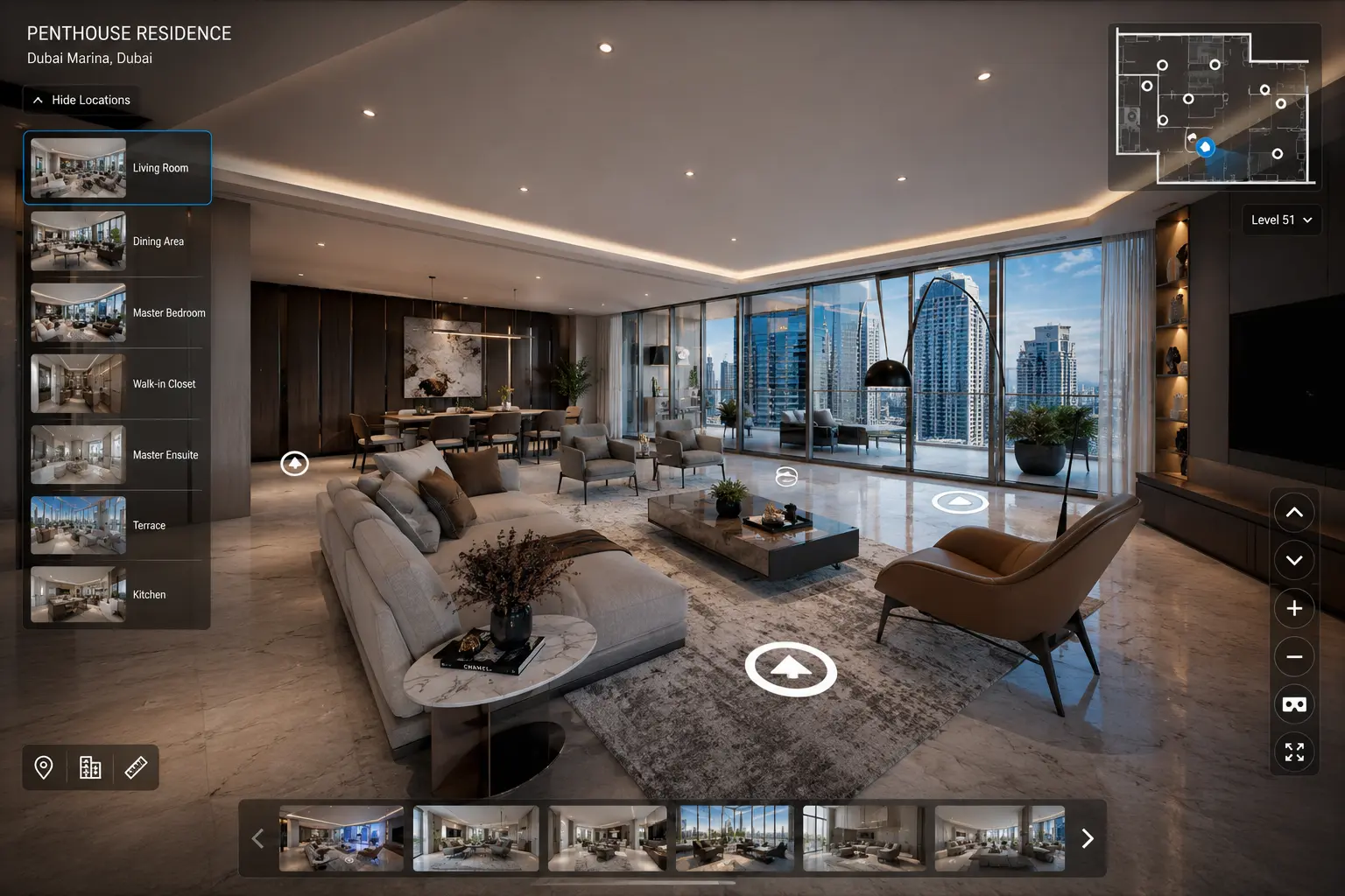
- 3D virtual tours and FM-ready digital twins
3D Scanning & BIM Services in Dubai
From the first laser scan to the final coordinated BIM model, every service below is delivered in-house with verifiable accuracy and files that drop straight into your workflow.

3D Modeling
Detailed 3D models of buildings, bridges, interiors, streets, and parks that give engineers and designers accurate visualisation for planning and execution.

BIM Services
Most BIM firms subcontract scanning. Most survey firms subcontract modeling. We do both — in-house, under one quality standard, with zero communication gaps.

3D Virtual Tours
Immersive, navigable virtual walkthroughs that showcase real estate, hospitality, and retail spaces far beyond static photos.

Floor Plans & Facade Plans
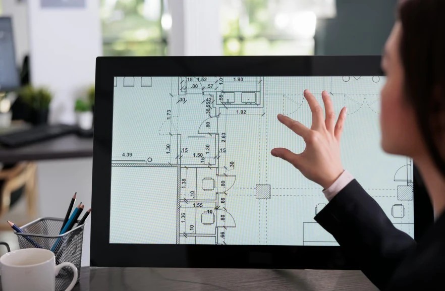
Accurate interior floor plans and exterior facade elevations from scanned data, ready for design, leasing, and approvals.

Digital Twin of Real Estate
Living digital replicas of your assets that keep geometry and data in sync for facilities management, operations, and long-term planning.

AutoCAD Drafting
Architectural, structural, and MEP AutoCAD drafting by an in-house team. Scan-to-CAD from our own GeoSLAM hardware.
Explore Every Service
Tap any service to see exactly what we capture, model, and deliver — and which file formats land in your inbox.
Survey-grade laser scanning that captures your entire site as a millimetre-accurate point cloud.
- Indoor & outdoor scanning
- Up to 1 mm accuracy
- MEP & structural capture
- Heritage & facade scanning
- Registration & cleaning
- RCP / E57 point cloud
We convert the point cloud into an intelligent, parametric Revit model of existing conditions.
- LOD 100–500
- Architectural modeling
- Structural modeling
- MEP modeling
- Clash detection
- RVT / IFC export
Verified existing-condition documentation generated directly from scan data.
- As-built floor plans
- Facade elevations
- Sections & details
- Renovation support
- Handover & compliance
- DWG / PDF delivery
Precise concrete and structural scanning for deviation, flatness, and condition analysis.
- Concrete scanning Dubai
- Surface deviation maps
- Floor flatness (FF/FL)
- Slab & column checks
- Heatmap reporting
- Pre-pour verification
Full BIM modeling and coordination for the entire project lifecycle.
- 3D coordination
- MEP BIM
- 4D / 5D BIM
- Family creation
- Clash detection
- COBie / IFC data
Accurate, standards-compliant Revit models ready for downstream design.
- Architectural Revit
- Structural Revit
- MEP families
- Sheets & schedules
- Custom templates
- RVT delivery
Immersive walkthroughs and living digital replicas for sales and facilities management.
- 360° virtual tours
- Real estate & retail
- Hospitality spaces
- Digital twin for FM
- Web-embeddable
- Linked asset data
Survey-grade terrain and site data for design, earthworks, and infrastructure.
- Topographic survey
- Contour mapping
- Volume / stockpile
- GNSS control
- Setting out
- DWG / CSV output
Precision You Can Build On
Verifiable Accuracy
Laser scanning precise to within 1 mm, suitable for BIM coordination and as-built work.
Years of Experience
Over 15 years delivering 3D scanning and modeling across the UAE.
BIM & Revit Team
Scanning and modeling under one roof — no outsourcing, faster turnaround.
Quick Turnaround
Agreed deadlines upfront, with field scans often completed in a single day.
UAE-Wide Coverage
Serving Dubai, Abu Dhabi, Sharjah, and the wider UAE from Business Bay.
Our Own Hardware
We own our GeoSLAM LiDAR and RTK GNSS equipment, so there are no rental delays. See equipment →
How Does 3D Scanning Work?
A simple four-step path from your physical site to coordinated, build-ready digital deliverables.
Scan & Capture
We laser-scan your building or site, recording millions of measured points on location.
Point Cloud Processing
Scans are registered and cleaned into a single, accurate point cloud dataset.
BIM / Revit Modeling
Our team builds intelligent Revit and BIM models from the point cloud to your standards.
Delivery
You receive RCP, RVT, DWG, IFC, and optional virtual tours — ready to use.
Industries We Support
Trusted by Industry Leaders
We collaborate with top architects, real estate developers, and businesses to deliver high-quality 3D solutions — the precision and innovation our clients rely on for architectural modeling, virtual tours, and BIM services.
What Our Clients Say
"Excellent service, promptness, professionalism and adherence to schedule. Very satisfied with working with you."
"We ordered jobs in different areas — scanning and modeling. Everything was done to our and the client's satisfaction."
"A professional, high-quality team with a high level of service and fair prices. The fastest we've worked with."
We also supply professional survey equipment — total stations, RTK GNSS receivers, and GeoSLAM LiDAR.
View Equipment →3D Scanning FAQs
3D laser scanning captures a physical space as millions of measured points called a point cloud. A scanner sweeps the site with laser pulses, recording the exact position of every surface. That data is then processed into accurate models, drawings, or virtual tours.
Sicher 3D delivers 3D laser scanning accurate to within 1 mm. This precision is suitable for as-built documentation, BIM coordination, clash detection, and heritage work where small deviations matter for construction and design decisions.
Scan to BIM is the process of converting a laser-scanned point cloud into an intelligent 3D building model in Revit. The result is a parametric BIM model of existing conditions that engineers and architects can edit, coordinate, and build from.
3D scanning cost in Dubai depends on site size, required accuracy, and deliverables such as point cloud, BIM, or as-built drawings. Sicher 3D provides a free, fixed quote after reviewing your project scope — contact us with your site details.
You receive your chosen formats: registered point cloud (RCP/E57), Revit model (RVT), CAD drawings (DWG), IFC for BIM exchange, and optional 3D virtual tours. We match deliverables to your workflow so files drop straight into your design tools.
Field scanning of a typical building or site takes a few hours to one day, depending on size and complexity. Point cloud processing and BIM modeling are completed afterward, with turnaround agreed upfront based on your deadline.
A 3D model shows geometry and appearance only. BIM (Building Information Modeling) adds intelligent data to every element — materials, dimensions, systems, and relationships — so the model supports coordination, clash detection, costing, and facility management.
Yes. Sicher 3D produces verified as-built surveys and drawings from laser-scanned data, documenting exactly what was constructed. These support renovations, handovers, compliance, and future modifications with reliable existing-condition accuracy.
Sicher 3D is based in Business Bay, Dubai, and provides 3D scanning, BIM, and modeling services across Dubai, Abu Dhabi, Sharjah, and the wider UAE.
Get a Free 3D Scanning Quote in Dubai
Tell us about your site and the deliverables you need. We'll respond with a clear, fixed quote — no obligation.
Park Lane Tower, Office 708, Business Bay, Dubai