Capture Space.
Recreate Reality.
Professional handheld LiDAR scanners for 3D mapping, BIM documentation, and spatial intelligence. From tunnels to towers — scan anything, anywhere.
Why GeoSLAM
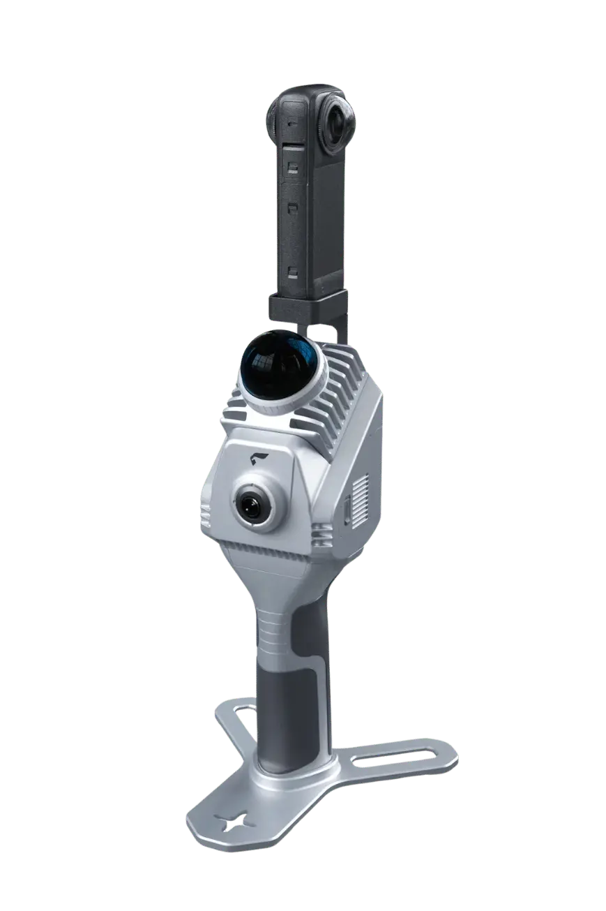
Handheld 3D LiDAR Scanning. Redefined.
GeoSLAM scanners combine advanced SLAM algorithms with high-performance LiDAR sensors to deliver rapid, precise 3D mapping — no tripods, no GPS dependency, no limits. Walk through any environment and capture millimeter-accurate point clouds in real time.
Choose Your Scanner
From entry-level mapping to GNSS-integrated precision, find the GeoSLAM solution engineered for your workflow.
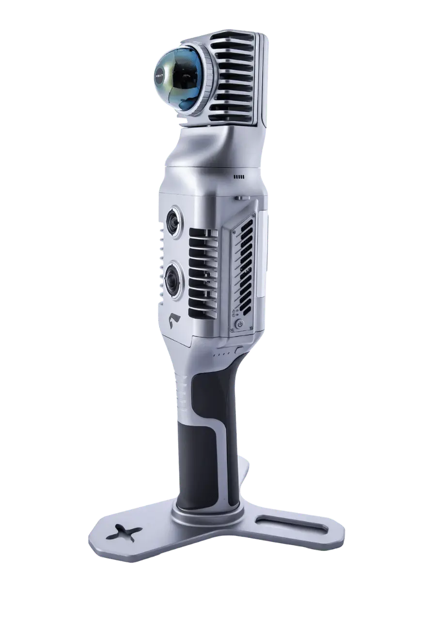
SLAM200E 32L
Maximum point density with 32 laser channels and 640K pts/sec. The ultimate choice for professionals demanding the highest data quality.
SLAM200E 16L
Advanced SLAM performance with 16 laser channels. Excellent balance of precision and value for demanding indoor/outdoor mapping.
SLAM200
Built-in GNSS for geo-referenced scanning outdoors with seamless indoor transition. One device, one workflow, global accuracy.
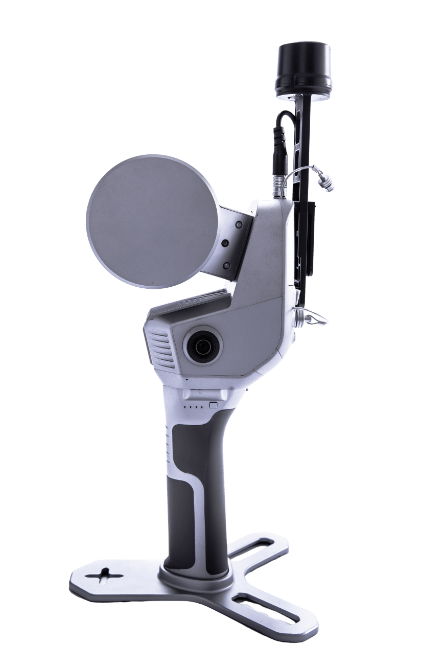
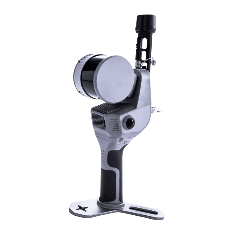
SLAM2000
Multi-platform versatility — mount on handheld, backpack, drone, vehicle, or tripod. Dual 12 MP cameras with texture and visual mapping for diverse scanning scenarios.
SLAM1000
Lightweight, cost-effective entry into professional 3D scanning. 12 MP color camera with true-color rendering in the lightest package at just 0.65 kg.
Experience SLAM Technology In Real Time
Explore how GeoSLAM transforms reality capture with high-speed mobile scanning, live point cloud generation, and professional-grade spatial intelligence workflows.
Engineered for
Real-World Performance
Advanced SLAM Algorithm
GeoSLAM's proprietary Simultaneous Localization and Mapping technology processes LiDAR, IMU, and visual data in real-time — delivering consistent accuracy in GPS-denied environments like tunnels, mines, and dense urban canyons without any external reference.
Panoramic Camera
Dual 12–48 MP cameras capture high-definition imagery for true-color point cloud colorization and photorealistic 3D reconstruction.
Walk-and-Scan Workflow
No tripods, no setup time. Simply walk through any space and capture dense, accurate point clouds at up to 640,000 points per second.
IP54 Rugged Protection
Built for the field — dust-resistant and splash-proof construction handles construction sites, mines, and outdoor environments.
Multi-Platform Mounting
The SLAM2000 supports handheld, backpack, drone, vehicle, and tripod mounting — adapting to any scanning scenario. Connect external RTK, power supply, or accessories via circular connector for extended field operations and maximum flexibility.
SLAM Technology
No GPS? No Problem. Scan Anywhere with Confidence.
GeoSLAM's SLAM engine fuses LiDAR, IMU, and visual sensors to build and track position in real-time — even deep underground or inside complex structures.
Compare Models Side by Side
Every GeoSLAM scanner is engineered for professional accuracy. Choose the model that matches your project requirements.
| Specification | SLAM200E 32LFlagship | SLAM200E 16LProfessional | SLAM200GNSS Integrated | SLAM2000Versatile | SLAM1000Entry Level |
|---|---|---|---|---|---|
| LiDAR Performance | |||||
| Scanning Range | Up to 300 m | Up to 300 m | Up to 300 m | Up to 70 m | Up to 70 m |
| Point Frequency | 640,000 pts/s | 320,000 pts/s | 320,000 pts/s | 200,000 pts/s | 200,000 pts/s |
| Laser Channels | 32 | 16 | — | — | — |
| FOV | 360°H, 270°V | 360°H, 270°V | 360°H, 270°V | 360°H, -7°~52°V | 360°H, -7°~52°V |
| Wavelength | 905 nm | 905 nm | 905 nm | 905 nm | 905 nm |
| Accuracy | |||||
| Relative Accuracy | 1 – 2 cm | 1 – 2 cm | 1 – 2 cm | ≤ 2 cm (post) / ≤ 3 cm (RT) | 2 cm @ 100 m |
| Point Cloud Thickness | 2 cm | 2 cm | 0.5 cm | ≤ 1 cm (post) / ≤ 2 cm (RT) | 1 cm |
| Absolute Accuracy | 3 cm | 3 cm | 3 cm | ≤ 5 cm (post) | — |
| Camera & Imaging | |||||
| Camera | Dual 12 MP Panoramic | Dual 12 MP Panoramic | Dual Camera | 12 MP Texture + 12 MP Visual | 12 MP Color |
| Camera FOV | 210° per camera | 210° per camera | 210° per camera | 210° Texture / 100° Visual | 360°H, -7°~52°V |
| Hardware | |||||
| Storage | 512 GB SSD | 512 GB SSD | 512 GB SSD | 512 GB SSD | 512 GB SSD |
| IP Rating | IP54 | IP54 | IP54 | IP54 | IP54 |
| Weight (scanner) | ~1.6 kg | ~1.6 kg | ~1.4 kg | 0.925 kg | 0.65 kg |
| Weight (w/ battery & base) | ~2.1 kg | ~2.1 kg | ~1.9 kg | 1.45 kg | 1.16 kg |
| Battery Endurance | ~70 min | ~70 min | ~70 min | ~95 min | ~1.7 hrs |
| Connectivity | |||||
| Built-in GNSS | — | — | Yes (RTK) | — (External S-RTK) | — |
| Wi-Fi | Yes | Yes | Yes | Yes | Yes |
| Bluetooth | Yes | Yes | Yes | — | Yes |
| Multi-Platform Mounting | — | — | — | Handheld / Backpack / Drone / Vehicle / Tripod | — |
Built for Every Environment
From heritage preservation to heavy construction — GeoSLAM scanners adapt to your industry's unique challenges.
Construction & BIM
As-built documentation, progress monitoring, and clash detection for modern construction workflows.
Surveying & GIS
Topographic mapping, volumetric analysis, and spatial data capture for land and infrastructure surveys.
Mining & Tunnels
Underground void analysis, convergence monitoring, and tunnel profile scanning in GPS-denied environments.
Heritage & Architecture
Non-invasive cultural heritage documentation, facade scanning, and historic building preservation records.
Facilities Management
Digital twin creation, space management, and infrastructure asset documentation for building operations.
Forestry & Vegetation
Tree canopy analysis, biomass estimation, and forest inventory using high-density point cloud data.
Simple. Fast. Powerful.
Four steps from walking through a space to delivering professional 3D outputs to your stakeholders.
Walk & Scan
Walk through any indoor or outdoor environment. No tripods, no control points needed.
Real-Time Preview
Monitor your 3D point cloud live on the mobile app with accuracy feedback.
Process & Refine
Auto-filter, colorize, and geo-reference with GeoSLAM processing software.
Export & Deliver
Output to LAS, PLY, E57, or integrate directly into BIM and CAD platforms.
Common Questions
Do GeoSLAM scanners require GPS to operate?
What accuracy can I expect from GeoSLAM scanners?
What is the difference between SLAM200E, SLAM2000, and SLAM1000?
Which file formats are supported for export?
How long does a typical scan take?
Does Sicher 3D provide training and support?
Ready to Transform Your Workflow?
Speak with our sales engineers to find the right GeoSLAM solution for your project requirements, budget, and timeline.