Construction Surveying
Foundation layout, column positioning, slab level checks, and as-built verification — the daily grind the iRTK5 was engineered for.


The iRTK5 doesn't chase features — it perfects the ones that matter. A next-generation GNSS engine tracks every operational constellation. Hi-Fix keeps you measuring when corrections drop. A 360° omni-directional antenna extends UHF range 20% further than side-mounted designs. And a 24-hour removable battery means you'll never charge during a shift again.
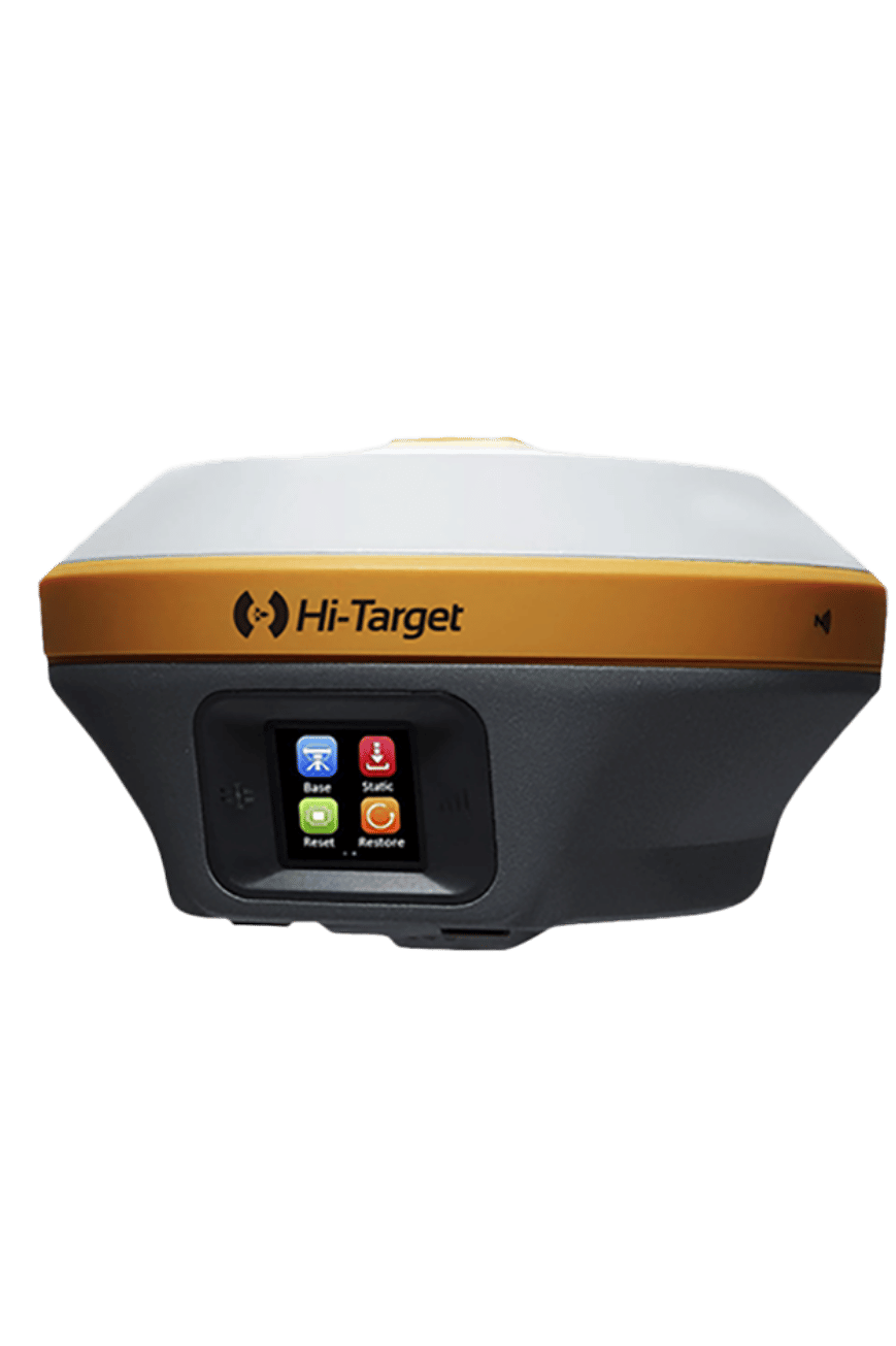
Survey crews don't need the flashiest receiver — they need the one that works. Every shift. Every site. Every season. The iRTK5 is engineered around three principles: don't run out of battery, don't lose your fix, and don't break when you drop it.
A 24-hour removable battery means no mid-shift charging. Hi-Fix maintains RTK accuracy for up to 5 minutes when corrections drop. IP67 waterproofing, MIL-STD-810G vibration/shock/salt-spray certification, and 2-meter concrete drop survival mean the iRTK5 handles everything the Middle East throws at it — 50°C heat, sandstorms, and the occasional pole-drop.
Full-wave GNSS antenna and next-generation engine track GPS, BDS, GLONASS, Galileo, QZSS, NavIC, and SBAS — plus B2b-PPP and Galileo E6-HAS precise-point services. Enhanced initialization speed and anti-noise performance compared to previous Hi-Target generations. In the Middle East sky with strong BDS + GPS + Galileo visibility, signal redundancy is unmatched.
Continuous RTK positioning for up to 5 minutes during base station or VRS correction outages. Cellular dropout, UHF interference, NTRIP timeout — Hi-Fix keeps you working.
Built-in IMU, no calibration walk. Less than 2 cm accuracy within 30° inclination. Immune to magnetic disturbances from rebar, steel, and construction equipment. 20% faster than bubble leveling.
Top-mounted radio antenna provides full 360° omni-directional UHF coverage, extending data transmit/receive range 20% longer than side-mounted designs. No dead zones on the pole.
Internal UHF (1-5W) + optional external (10-35W). Protocols: Hi-Target, TRIMTALK450S, TRIMMARK III, SATEL-3AS, TRANSEOT. Works with Trimble, Leica, and other base stations.
The iRTK5 is certified to survive dust storms (IP67), vibration and shock (MIL-STD-810G 514.6), salt spray corrosion (MIL-STD-810G 509.4, 96h), immersion to 1m depth (IP67), and a 2-meter natural fall onto concrete (MIL-STD-810G 516.6). Auto-adjusting thermal management keeps the receiver operating from −40 °C to +75 °C. This is the receiver that survives the worst day on every construction site in the Gulf.
| GNSS Signal Tracking | |
| Channels | 1408 |
| GPS | L1C/A, L1C, L2P(Y), L2C, L5 |
| BDS | B1I, B2I, B3I, B1C, B2a, B2b |
| GLONASS | L1, L2, L3 |
| Galileo | E1, E5a, E5b, E6 |
| QZSS / NavIC / SBAS | L1/L2/L5/L6* · L5 · L1/L2/L5 |
| PPP | B2b-PPP, Galileo E6-HAS |
| Positioning Performance | |
| High-Precision Static (H / V) | 2.5 mm + 0.1 ppm / 3.5 mm + 0.4 ppm |
| Static & Fast Static (H / V) | 2.5 mm + 0.5 ppm / 5 mm + 0.5 ppm |
| PPK (H / V) | 8 mm + 1 ppm / 15 mm + 1 ppm |
| RTK (H / V) | 8 mm + 1 ppm / 15 mm + 1 ppm |
| Network RTK VRS/FKP/MAC (H / V) | 8 mm + 0.5 ppm / 15 mm + 0.5 ppm |
| RTK Init Time / Reliability | 2–10 s / > 99.99% |
| Hi-Fix (H / V) | RTK + 10 mm/min / RTK + 20 mm/min |
| PPP (H / V) | 10 cm / 20 cm |
| SBAS (H / V) | 0.5 m / 0.85 m |
| Positioning Rate | 1 / 5 / 10 Hz |
| Raw Data Update Rate | Up to 50 Hz |
| Tilt Survey | |
| Tilt Performance | 8 mm + 0.7 mm/° tilt (0°–60°) |
| Accuracy at 30° | < 2 cm |
| Calibration | None required (magnetic-immune) |
| Communication | |
| Internal UHF Radio | 403–473 MHz, 1–5 W |
| External UHF Radio (Optional) | 403–473 MHz, 10 / 35 W |
| UHF Protocols | HI-TARGET, TRIMTALK450S, TRIMMARK III, SATEL-3AS, TRANSEOT |
| Cellular | LTE, WCDMA, EDGE, GPRS, GSM (full-band) |
| Wi-Fi | 2.4 GHz, 802.11 b/g/n |
| Bluetooth / NFC | BT 4.0 / 2.1+EDR · NFC |
| I/O | USB 3.0 OTG, 5-pin DC, SMA, SIM slot |
| CORS Range | 20–50 km |
| System | |
| Storage | 16 GB circulating |
| Display | 1.3" OLED touchscreen |
| Data Formats | NMEA-0183, GNS, RINEX (dual), RTCM2.X/3.X, CMR |
| Network Mode | VRS, FKP, MAC · NTRIP |
| Power | |
| Battery | 7.2 V / 6,900 mAh Li-ion, removable |
| RTK Rover Duration | 24 hours (UHF / Cellular) |
| Quick Charge | 3.5 hours full |
| External Power | 6–28 V DC, auto-switching |
| Power Consumption | 4.4 W |
| Physical & Environmental | |
| Dimensions (Ø × H) | 158 × 98 mm |
| Weight | < 1.3 kg (with battery) |
| Operating Temperature | −40 °C to +75 °C |
| Storage Temperature | −50 °C to +85 °C |
| IP Rating | IP67 (1 m immersion) |
| Shock / Vibration | MIL-STD-810G, 514.6 |
| Salt Spray | MIL-STD-810G, 509.4 (96 h) |
| Free Fall | 2 m onto concrete |
Foundation layout, column positioning, slab level checks, and as-built verification — the daily grind the iRTK5 was engineered for.
Centerline staking, cross-sections, earthwork volumes, and road design with Hi-Survey software.
High-volume point capture across large sites with 24-hour battery endurance and Hi-Fix continuity.
Tilt survey speeds up boundary corner capture near fences, walls, and existing structures.
10 Hz positioning for dynamic GIS data collection across utility, environmental, and municipal projects.
2.5 mm + 0.1 ppm static accuracy for control network establishment and high-order survey work.
Talk to our sales engineers about iRTK5 configuration, pricing, and on-site demo options. We'll help you spec the right base+rover bundle and arrange training for your crew.