Permanent CORS Stations
National and regional reference station networks serving unlimited RTK rovers. The primary antenna class specified by government CORS standards.


Every centimeter of RTK accuracy your rovers deliver starts with the phase center stability of the reference antenna. The AT-45101CP's unique 3D choke ring design suppresses multipath interference in all three dimensions, achieving ≤±1 mm phase center offset — the tightest specification in the Hi-Target lineup. Certified by both IGS and NGS, it has been deployed in national CORS networks, power grid monitoring systems, and provincial reference station arrays worldwide.
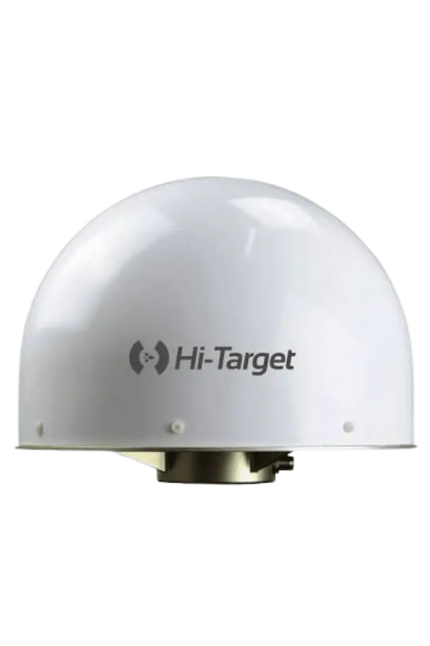
A CORS station is only as good as its antenna. Multipath signals — radio waves bouncing off buildings, ground surfaces, and metal structures — are the primary error source in permanent reference installations. The AT-45101CP's 3D choke ring geometry suppresses these reflections across every GNSS frequency band including L-Band, maintaining sub-millimeter phase center stability regardless of satellite elevation angle or ground-plane conditions.
IGS and NGS certification means the antenna's electrical characteristics have been independently calibrated and published — every GNSS processing software in the world can correct for its specific biases. This is the antenna that national geodetic agencies, power utility companies, and government CORS operators trust for their most critical reference infrastructure.
Traditional choke rings suppress multipath in a single plane. The AT-45101CP's unique 3D design extends rejection into all three spatial dimensions, achieving sub-millimeter (≤±1mm) phase center stability across every GNSS frequency band — GPS L1/L2/L5, BDS B1/B2/B3, GLONASS G1/G2/G3, Galileo E1/E5a/E5b/E6, QZSS, NavIC, SBAS, and L-Band. Every error you suppress at the antenna is an error that never reaches your rovers.
Independently calibrated and published by both IGS and NGS. Processing software corrects for antenna-specific biases automatically. Required by most government CORS specifications.
Tracks all operational GNSS constellations plus L-Band PPP correction services. Dual-band coverage: 1160–1300 MHz (lower) and 1521–1621 MHz (upper).
45 dB ± 3 dB gain, ≤2 dB noise figure, VSWR ≤2, pass-band ripple ±1.5 dB. Operates from 3–16 VDC at ≤45 mA. Low power, high signal quality.
Deployed in China Mobile HAP, national power grid monitoring systems, and provincial CORS centers. Proven reliability in 24/7 permanent installations spanning years of continuous operation.
IP67 environmental protection against dust and temporary water immersion. Operating range from −45°C to +85°C covers every climate zone from arctic monitoring stations to Middle East desert installations. 95% humidity tolerance. Φ377mm × 271mm form factor with TNC connector. At 5 kg, the antenna provides the mechanical stability that permanent monuments require — no vibration, no wind-induced phase errors, no maintenance.
| Signal Tracking | |
| GPS | L1, L2, L5 |
| GLONASS | G1, G2, G3 |
| BDS | B1, B2, B3 |
| Galileo | E1, E5a, E5b, E6 |
| Other | QZSS, NavIC, SBAS, L-Band |
| Antenna Performance | |
| Polarization | RHCP (Right-Handed Circular) |
| Antenna Axis Ratio | < 2 dB |
| Nominal Impedance | 50 Ω |
| Elevation Coverage | 360° |
| Maximum Gain | ≥ 7 dBi |
| Phase Center Offset | ≤ ±1 mm |
| LNA Performance | |
| LNA Gain | 45 dB ± 3 dB |
| Noise Figure | ≤ 2 dB |
| VSWR | ≤ 2 |
| Pass-band Ripple | ± 1.5 dB |
| Differential Propagation Delay | ≤ 5 ns |
| Operating Frequency | |
| Lower Band | 1160 MHz – 1300 MHz |
| Upper Band | 1521 MHz – 1621 MHz |
| Power | |
| Working Voltage | 3 – 16 V DC |
| Power Consumption | ≤ 45 mA |
| Physical & Environmental | |
| Dimensions | Φ 377 mm × 271 mm |
| Weight | 5,000 g (5 kg) |
| Connector | TNC |
| IP Rating | IP67 |
| Operating Temperature | −45 °C to +85 °C |
| Storage Temperature | −55 °C to +85 °C |
| Humidity | 95% |
| Certifications | |
| IGS (International GNSS Service) | Certified |
| NGS (National Geodetic Survey) | Certified |
National and regional reference station networks serving unlimited RTK rovers. The primary antenna class specified by government CORS standards.
Bridge deflection, dam settlement, building tilt, and geological hazard arrays where sub-millimeter repeatability determines detection threshold.
Transmission tower monitoring and power grid GNSS timing networks. Deployed in China Mobile HAP and national power utilities.
National geodetic datum establishment, tectonic plate monitoring, and first-order control survey campaigns requiring IGS-calibrated antenna models.
GNSS meteorology and tropospheric delay estimation for weather prediction models using permanent station data.
GNSS-based precision timing for telecommunications, financial trading, and critical infrastructure synchronization.
Talk to our engineers about AT-45101CP pricing, VNet8 bundles, and turnkey CORS station deployment across UAE and GCC.