

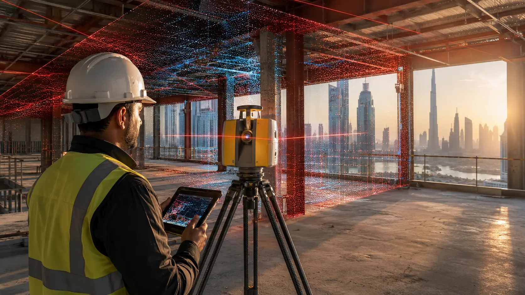
What is 3D laser scanning?
3D laser scanning — also called LiDAR scanning, reality capture, or 3D scanning — is a survey technique that fires hundreds of thousands of laser pulses per second at a physical space and measures how long each pulse takes to bounce back. The result is a point cloud: a dense 3D dataset of the surveyed environment, accurate to within a few millimetres, with every wall, beam, duct, and pipe recorded exactly as it stands today.
What is terrestrial laser scanning?
Terrestrial laser scanning (TLS) is the tripod-mounted version of the technology — the format used on 80–90% of Dubai construction and refurbishment projects. Instruments like the FARO Focus, Leica RTC360, and Trimble X12 sit on fixed positions across a site, sweep the space through a full 360°×300° field, and capture a stationary scan of exceptional accuracy. For occupied buildings, complex geometry, and heritage work, TLS remains the reference standard.
Three practical types of 3D scanning are in use in Dubai today:
- Terrestrial laser scanning (TLS) — tripod-mounted scanners (FARO Focus, Leica RTC360, Trimble X12). Highest accuracy, best for buildings, plants, and heritage work.
- Mobile laser scanning (MMS) — backpack, trolley, or wearable systems (NavVis VLX, Leica BLK2GO, FARO Orbis) that capture while the operator walks. Fastest for large floor plates and complex indoor environments.
- Aerial / drone LiDAR — UAV-mounted scanners for large sites, roads, and topographic work where a tripod would take days.
Sicher 3D operates all three depending on what a project actually needs — because choosing the wrong tool is the single biggest cost overrun on a scanning job.
Why Dubai projects need laser scanning now
Dubai's push toward mandatory BIM has run in three regulatory waves — and the third wave is what changed the market:
| Regulation | Year | What it changed |
|---|---|---|
| Dubai Municipality Circular 196 | 2013 | First BIM mandate — required for buildings over 40 floors, over 300,000 sq ft, specialised buildings (hospitals, universities), and foreign-office projects. |
| Dubai Municipality Circular 207 | 2015 | Extended BIM to architectural and mechanical works for the same building categories. |
| Dubai Municipality Circular 9-1-2 | Oct 2023 · enforced 1 Jan 2024 | Requires a 3D BIM model with every new building permit application — architectural BIM for buildings above 20 floors, structural BIM above 40 floors, complexes above 20,000 sqm (architectural) / 30,000 sqm (structural), all hospitals and universities, and all government projects. |
The 2024 rule is the operative one today. In practice it means two things for anyone with an existing structure in scope — refurbishment, extension, MEP retrofit, façade replacement, or handover documentation:
- A 2D CAD as-built no longer satisfies Dubai Municipality's submission requirements for regulated projects. You need a coordinated, ISO 19650–aligned BIM model.
- The most reliable, audit-defensible way to produce that BIM model is from a laser-scanned point cloud — because a scan captures the building exactly as it stands today, not as the 2004 drawings said it should.
Dubai's alignment with ISO 19650 (the international BIM standard) and IFC (Industry Foundation Classes, the open-format spec that keeps your model readable across software) has made the accuracy question non-negotiable. Municipality reviewers can and do reject models that don't match the physical site.
For deep BIM-modelling scope beyond the scanning phase, see our overview of BIM services in Dubai — and for the full scan to BIM workflow, our scan to BIM Dubai guide is next in this series.
How does 3D laser scanning work? The 4-stage process
Every professional 3D scanning job in Dubai runs through the same four stages. If any provider skips one of them — especially registration or QC — the deliverable will fail at the modelling stage, and the cost lands back on the client.
Stage 1 · Site planning & control
Before anyone brings a scanner on site, our team walks the building with the client, identifies scope boundaries, checks access for tripod-only versus mobile scanning, and — for anything above 5,000 sqm — establishes a survey control network so multiple scan sessions can be tied to a single coordinate system. On sites where the boundary is external, we tie the control network to the site's topographic survey so scan data matches the existing site plan. This is where projects are quietly saved or lost.
Stage 2 · Field capture
The scanner is moved from position to position, each scan overlapping the last by roughly 30% so the software can stitch them together. A typical 3,000 sqm floor plate takes 40–80 scan positions and one to two working days on site, depending on obstruction density.
Stage 3 · Registration & processing
Back in the office, individual scans are registered (aligned into a single unified point cloud) using cloud-to-cloud algorithms and, where higher rigour is needed, checked against the survey control network. Registration is where accuracy is either preserved or thrown away. A ±2 mm scanner registered badly produces a ±20 mm point cloud.
Stage 4 · Deliverable production & QC
The registered cloud is exported in the formats the client's downstream team needs (see the next section), then a second independent QC pass compares the deliverable back to the raw data. On our jobs, this pass is run by an engineer who did not do the registration — because a checker who is also the doer catches nothing.
Deliverables: E57, RCP, RVT, IFC — what to demand
The most expensive mistake we see on Dubai scan to BIM projects is a client who accepts whatever file format the vendor happens to prefer, and only discovers three months later that their Revit team cannot open it. Here is the cheat sheet:
| File format | What it is | When you need it |
|---|---|---|
| .E57 | The vendor-neutral open point cloud standard (ASTM E2807). Readable by every major CAD/BIM platform. | Always demand this. It is your insurance against vendor lock-in. |
| .RCP + .RCS | Autodesk ReCap Project + Scan files. The indexed, "ready-to-drop-into-Revit" format. | Required if your architects, MEP consultants, or structural team work in Revit, AutoCAD, or Navisworks (i.e. 90% of Dubai firms). |
| .LAS / .LAZ | ASPRS-standard format, common in aerial and topographic work. | Site-wide surveys, road/infrastructure, GIS integration. |
| .RVT | Native Autodesk Revit BIM model. | The finished scan to BIM deliverable. Always specify the exact Revit year (Revit files are not backward-compatible). |
| .IFC | Open, vendor-neutral BIM exchange format. Required by ISO 19650 workflows and Dubai Municipality submissions. | Non-negotiable for permit-track projects under the 2024 mandate. |
| .NWC / .NWD | Autodesk Navisworks — for federated clash detection across disciplines. | Multi-disciplinary coordination and construction sequencing. |
Accuracy standards: LOA, LOD, and what "±2 mm" really means
Professional 3D laser scanning in Dubai typically delivers ±2 mm to ±5 mm registered accuracy for terrestrial scanning, and roughly ±5 mm to ±8 mm for mobile mapping — measured under real site conditions, not manufacturer lab specs.
Two acronyms decide whether a deliverable is fit for purpose:
- LOA (Level of Accuracy) — the dimensional tolerance of the spatial data. Published by the U.S. Institute of Building Documentation (USIBD) as the LOA Specification. Ranges from LOA10 (± 5 cm) at the loose end to LOA50 (± 1 mm) at the surveying-grade end.
- LOD (Level of Development) — the informational completeness of the BIM modeling output. LOD 200 is generic geometry; LOD 300 is dimensionally correct elements; LOD 400 is fabrication-ready; LOD 500 is verified as-built.
These two are not the same thing, and clients get billed for the confusion every day. A model can be LOD 400 (highly detailed) and LOA 20 (dimensionally sloppy) at the same time. Always specify both in your scope of work.
For a typical Dubai commercial refurbishment, we recommend LOA 30 (±15 mm) with LOD 300 modelling — enough accuracy for MEP clash detection, without the cost blow-out of LOA 50 surveying-grade capture.
Where Dubai clients use 3D scanning most
Across our project book, five use-cases account for roughly 85% of 3D laser scanning demand in the UAE:
1. Refurbishment and fit-out
Business Bay towers, DIFC office fit-outs, Downtown residential upgrades. Scanning eliminates the "the drawings don't match the building" problem that drives ~30% of change orders on refurbishment work.
2. MEP retrofits and coordination
Mechanical, electrical, and plumbing services in operational buildings (hotels, hospitals, malls). Scan-based clash detection has been shown to reduce Requests for Information (RFIs) by around 30% on complex projects. For coordinated MEP output, this is where scan-to-BIM feeds directly into a discipline-federated BIM services workflow.
3. As-built documentation for handover
Required by Dubai Municipality on regulated projects, and increasingly demanded by owners for facility management. Sicher 3D delivers formal as built survey packages under the 2024 BIM mandate.
4. Digital twins for asset management
Hotels, retail, and industrial facilities using the point cloud + BIM model as a live operational reference. Dubai's smart-city direction has made digital twin delivery one of the fastest-growing service lines in the UAE — and every digital twin worth its name starts life as a laser scan.
5. Site engineering & topographic work
For land parcels, road corridors, and external site works, scanning is usually paired with — or replaced by — a proper topographic survey, which Sicher 3D delivers to Dubai Municipality submission standard.
6. Heritage and specialist documentation
Al Fahidi, Al Shindagha, and other conservation zones where physical measurement is either impossible or would damage the fabric.
How much does 3D laser scanning cost in Dubai?
3D laser scanning in Dubai typically costs between AED 8,000 for a small commercial fit-out and AED 400,000+ for a full-building MEP as-built at LOD 300. Pricing is driven by five variables, not floor area alone:
- Total point cloud volume (site size × required density)
- Access difficulty (occupied building, night work, permit-restricted zones)
- Required accuracy (LOA 30 vs LOA 50 changes the crew size and rig)
- Deliverable scope (raw point cloud only vs full LOD 300 Revit model in IFC)
- Turnaround (standard 10–15 working days vs expedited 3–5 days)
For a fair market range in Dubai in 2026, budget:
| Project type | Typical range (AED) |
|---|---|
| Small commercial fit-out (up to 500 sqm), scan + point cloud only | 8,000 – 18,000 |
| Full-floor office refurbishment (1,500 – 3,000 sqm), scan-to-BIM LOD 300 | 40,000 – 90,000 |
| Full-building MEP as-built (10,000 sqm+), scan-to-BIM LOD 300 with IFC | 150,000 – 400,000+ |
| Heritage or specialist documentation | Priced per project |
How to choose a 3D scanning provider in Dubai
Ask any provider you're evaluating these seven questions before signing:
- Which scanner models will you actually use on my project, and what is their registered accuracy in real site conditions? ("Manufacturer spec" is not an answer.)
- Do you establish an independent survey control network for jobs over 5,000 sqm?
- What is your quality control workflow — specifically, is registration checked by an engineer who did not do the registration?
- Will you deliver E57 (open point cloud) alongside RCP/RCS, or Autodesk-only?
- Which USIBD LOA level are you delivering, and which BIM LOD?
- Are your deliverables ISO 19650 compliant and IFC exportable for Dubai Municipality submission?
- Can you show me three completed Dubai projects of similar scope, and can I speak to those clients?
Any provider that hedges on questions 3, 5, or 6 is telling you the answer without saying it out loud.
Ready to scan a Dubai project?
Sicher 3D has delivered 3D laser scanning and scan-to-BIM services on 500+ UAE projects across 15+ years — from Downtown residential towers and Business Bay fit-outs to hospitals, industrial plants, and Dubai Municipality permit submissions under the 2024 BIM mandate.