Key takeaways
- LiDAR measures geometry directly; photogrammetry reconstructs it from photos.
- For interiors, MEP and BIM, laser scanning is generally more reliable because it does not depend on light or texture.
- Photogrammetry excels at colour, texture, façades and large outdoor areas, especially from drones.
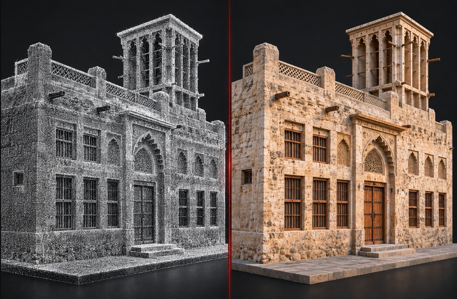
- Combining both gives accurate geometry with realistic colour.
How each method works
3D laser scanning
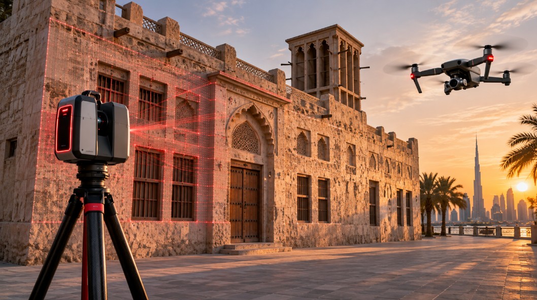
A scanner sends laser pulses and measures the distance to every surface it hits, producing a point cloud of millions of measured XYZ points. Terrestrial scanners work from tripods; SLAM scanners are handheld or backpack-mounted and capture while you walk.
Photogrammetry
A camera, often on a drone, takes many overlapping photos. Software matches features between photos and calculates 3D positions, producing a point cloud, textured mesh or orthophoto. Scale and position come from ground control points or GNSS.
LiDAR vs photogrammetry: side-by-side
| Factor | 3D laser scanning (LiDAR) | Photogrammetry |
|---|---|---|
| How geometry is measured | Directly, by laser distance | Calculated from matched photo features |
| Lighting | Works in dark rooms and ceiling voids | Needs good, even light |
| Plain or uniform surfaces | Measures them well | Struggles: few features to match |
| Glass and mirrors | Can create reflections and noise | Also difficult |
| Colour and texture | Optional colour from scanner camera | Excellent, photo-realistic |
| Interiors and MEP | Strong | Weak in tight or dark spaces |
| Large outdoor areas | Good; slower on foot | Fast, especially by drone |
| Equipment cost | Higher | Lower |
| Typical outputs | Point cloud (RCP, E57, LAS) | Point cloud, textured mesh, orthophoto |
Which is more accurate?
For building geometry, laser scanning is generally the more dependable method, because each point is a direct measurement. Photogrammetry accuracy depends on camera quality, photo overlap, distance to the object, lighting, surface texture and ground control, so results vary more from site to site.
Both methods can be tied to survey control (for example, RTK GNSS or a total station) when coordinates matter. Required accuracy, control checks and deliverables are agreed for each project, based on the site conditions and the chosen survey method.
When to choose each
Choose laser scanning for
- Scan to BIM and Revit models
- Interiors, plant rooms and ceiling voids
- MEP and structural as-builts
- Floor and wall deviation checks
- Projects where measurements must be reliable everywhere
Choose photogrammetry for
- Large sites, roofs and terrain by drone
- Façade colour and texture records
- Visual heritage documentation
- Quick progress imagery
- Textured models for presentations
On many projects, a laser scan provides the measured geometry and photogrammetry adds colour, roof or site coverage. The two datasets can be aligned into one coordinate system.
Site conditions in Dubai and the UAE
- Glass façades: common on UAE towers; both methods need planning to manage reflections.
- Strong sunlight and heat: harsh shadows affect photo quality; scanning schedules often avoid peak heat for crew and equipment.
- Occupied buildings: handheld SLAM scanning captures quickly with less disruption to tenants.
- Drone rules: drone photogrammetry in the UAE requires the relevant authority approvals, which adds lead time.
Sicher 3D owns its LiDAR and GNSS equipment and models in-house, so the capture method is chosen for the deliverable, not for what equipment is available to rent.
Frequently asked questions
What is the difference between LiDAR and photogrammetry?
LiDAR measures distances directly with laser pulses to create a point cloud. Photogrammetry calculates 3D shape by matching features across many overlapping photos. LiDAR is stronger for geometry and interiors; photogrammetry is stronger for colour, texture and large outdoor areas.
Is laser scanning more accurate than photogrammetry?
For buildings and interiors, laser scanning is generally more reliable because every point is measured directly. Photogrammetry accuracy depends heavily on photo quality, overlap, lighting, surface texture and ground control, so it varies more between sites.
Can photogrammetry be used for scan to BIM?
It can for simple exteriors, but interiors with plain walls, dark ceiling voids and MEP are difficult for photogrammetry. Most scan to BIM projects use laser scanning for geometry and may add photos for reference and colour.
Is photogrammetry cheaper than laser scanning?
The equipment is usually cheaper and drone photogrammetry is fast over large areas. However, total cost depends on the deliverable: if extra site visits or rework are needed to fill gaps, the savings can disappear.
Can LiDAR and photogrammetry be combined?
Yes. A common approach is laser scanning for measured geometry and photogrammetry for colour, roofs or wider site coverage, with both datasets aligned to the same survey control.
Does a laser scanner capture colour?
Many scanners have built-in cameras that add colour to the point cloud. The colour is good for reference, but photogrammetry usually gives more realistic textures.